The Sanabrés Way carries pilgrims from the Castilian plateau into green Galicia through Puebla de Sanabria, the mountains of A Gudiña and the thermal city of Ourense. It is the northwestern conclusion of a much longer family of southern routes. The landscape changes dramatically along the way: dry oak country gives way to granite villages, wooded valleys, hot springs and the monasteries of inland Galicia.
Vía de la Plata, Mozárabe and Sanabrés: what the names mean
These names overlap, which is why maps and travel accounts do not always use them in the same way.
- The Vía de la Plata runs north from Seville through Mérida, Cáceres and Salamanca to Zamora and Astorga. Its name probably comes from the Arabic balata, meaning a paved road, rather than from silver. Much of its identity comes from Roman roads linking Emerita Augusta, modern Mérida, with the north.
- The Mozárabe Ways begin farther south and east, including routes from Almería, Granada, Málaga, Córdoba and Jaén. They cross Andalusia to join the Vía de la Plata around Mérida. “Mozárabe” recalls the Christians who lived under Muslim rule and the cultural world of medieval al-Andalus; it is not another name for every southern stage.
- The Sanabrés Way branches northwest near Granja de Moreruela, north of Zamora. It passes through the historical district of Sanabria and enters Galicia toward Ourense, continuing to Santiago through Cea and the Deza countryside.
A pilgrim who starts in Seville may therefore say they are walking the Vía de la Plata, then follow the Sanabrés branch rather than continue north to Astorga and the French Way. Someone starting in Granada may first walk a Mozárabe route, join the Vía de la Plata and finish on the Sanabrés. The names describe connected parts of one long journey.
Roman roads and mountain entrances
The southern corridor grew around Roman communications, livestock tracks and practical river crossings. The Sanabrés branch was never one continuous paved Roman highway. It reused valleys and passes through country that merchants, drovers, soldiers and travelers already knew.
The ruins of Castrotorafe stand near the early split, above the Esla reservoir. Farther west, Puebla de Sanabria rises around a remarkably preserved medieval center and the fifteenth-century castle of the Counts of Benavente. Its stone houses and defensive position explain why this small town controlled movement near the Portuguese frontier and the mountain approach to Galicia.
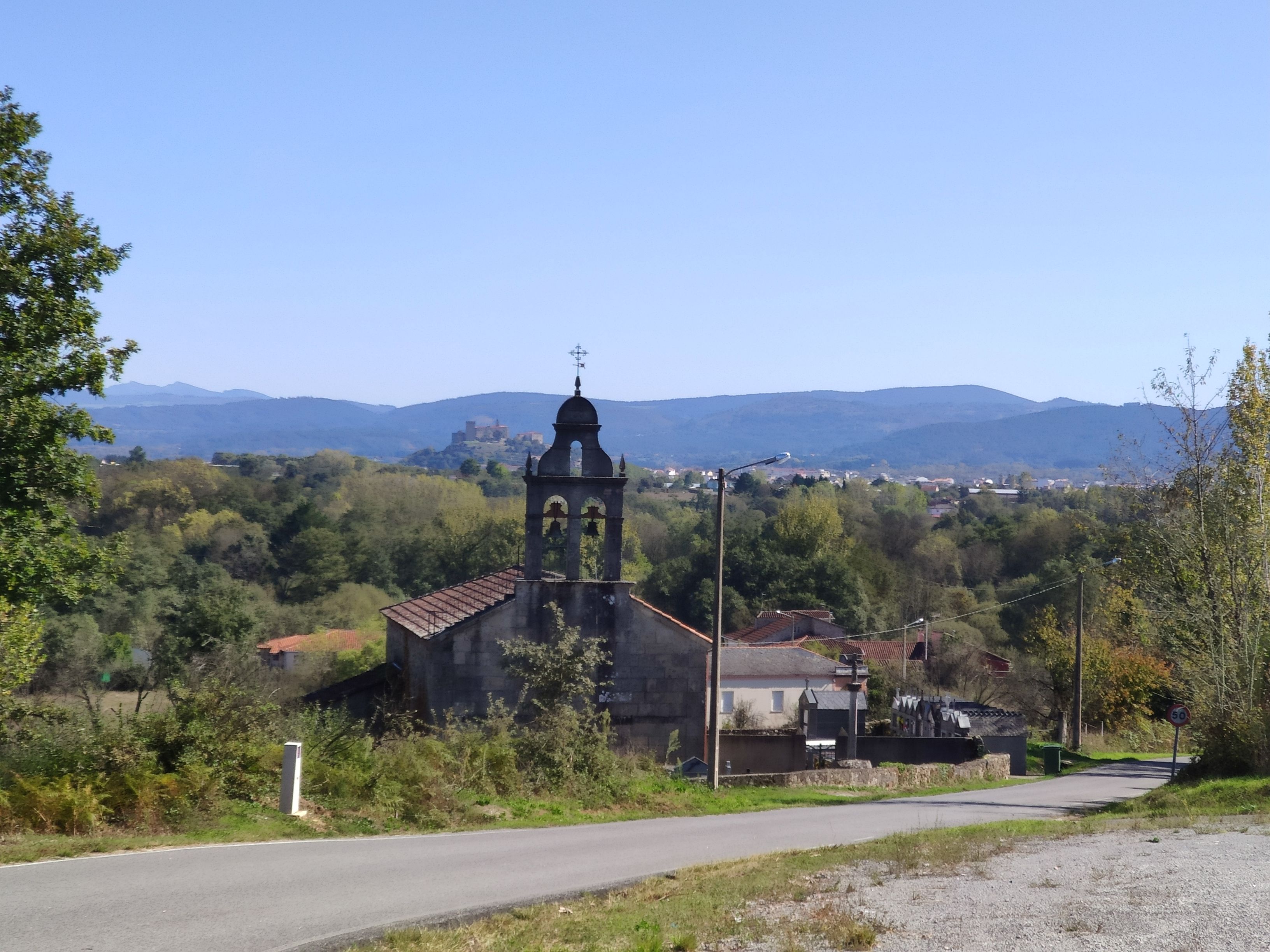
Beyond Puebla, the route climbs through Requejo and Padornelo before reaching Lubian. The sanctuary of A Tuiza, with its compact late-Baroque church, sits in a landscape where Galician language and building traditions begin to appear before the administrative border. The passage into Galicia at A Gudiña feels earned: broad Castilian horizons give way to close valleys, slate, granite and winding roads.
Towns and institutions
From A Gudiña the Camino has historical alternatives. The northern line passes through Laza; the southern line reaches Verín and the fortress of Monterrei before returning toward Xinzo and Allariz. The Laza country is famous for Entroido, one of Galicia’s most intense Carnival traditions, when masked peliqueiros run through the streets with bells at their waists. The Monterrei valley has a warmer climate, vineyards and one of Galicia’s smallest wine denominations.
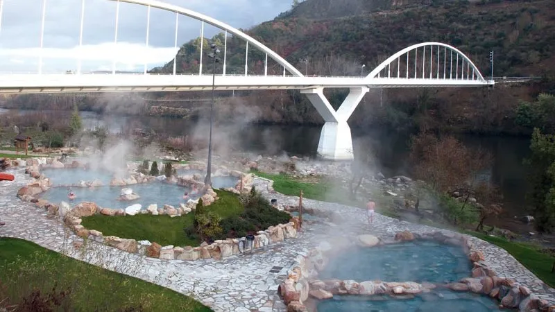
Ourense is the great city of the Sanabrés Way. Roman settlers valued its thermal springs, and hot water still rises in the old center at As Burgas. The medieval bridge over the Miño, the Romanesque cathedral and the lively tapas streets reward an extra night. Public thermal pools along the river turn recovery into part of the city experience, while the old town feels unmistakably Galician after the long approach from the plateau.
North of Ourense, San Cristovo de Cea is known for its wood-fired bread, protected by its own geographical indication. The detour to the Cistercian monastery of Oseira adds distance and climbing, but the vast church, cloisters and isolated valley make it one of the defining visits of the route. Founded in the twelfth century, the monastery became a powerful center of landholding, worship and hospitality.
The final country is softer and more agricultural. The Camino crosses the Deza region through places such as Dozón, Lalín and Silleda, then meets the route traditionally used by pilgrims arriving from the southeast. At Pico Sacro, the distinctive quartz summit appears in the legends of the Apostle’s arrival in Galicia. From there Santiago finally feels close.
Pilgrim hospitals, monasteries and market towns supported people arriving from Andalusia, Extremadura, Castile and Portugal. That mixed origin still defines the route better than a list of celebrated walkers: it feels like several Iberian roads gathering into one final approach.
How it compares
The Sanabrés is quieter than the French and Portuguese Ways, with longer gaps between services and more exposure to heat and mountain weather. In return it offers a rare progression from fortress town to remote pass, thermal city, monastery and green Galician farmland. It suits experienced walkers and travelers who want a genuine long-distance route without the crowds after Sarria or Tui.
The Xunta’s route maps and profiles are available through our official Silver and Sanabrés Way PDF resource.
Our Sanabrés Way At Your Pace adapts the route with confirmed accommodation and transfers where the historic geography does not produce convenient modern stages.