Granite defines many Galician buildings, but Galicia is not one geological block. Granite and metamorphic rocks such as schist, slate and quartzite belong to a much older landscape assembled during continental collisions hundreds of millions of years ago. Faults, rivers, weather and the Atlantic later cut that foundation into the country seen from the Camino.
The rounded granite boulders near the coast and the hard ridges inland are products of different rocks and patterns of weathering. Water enters fractures, minerals alter and blocks gradually lose their sharp edges. Road cuttings and old quarries reveal the structures hidden beneath pasture and forest.
How the rías formed
A ría is a coastal inlet created where the sea occupies the lower part of a river valley. Rivers first carved valleys while sea level was lower. Changes in sea level, together with slow movements and tilting of the land, allowed Atlantic water to flood their lower courses. The resulting inlets keep a branching shape inherited from their river systems.
The process was neither one single flood nor one moment of creation. Different Galician rías have different orientations, depths and geological controls. The broad Rías Baixas are especially visible around Vigo, Pontevedra, Arousa and Muros-Noia. Their sheltered waters and nutrient circulation help explain the success of shellfish cultivation.
The handprint legend
The local story is more immediate. When God finished creating the world, he rested on Monte Santa Trega. The ground was muddy and he slipped, placing his right hand on the coast to steady himself. His five fingers left the great southern rías. When he shook the mud from his hand, the scattered pieces became the islands.
In the Galician legend, God rested his hand on the land and the sea entered between his fingers, creating the rías. The view from Santa Trega makes the image easy to understand. Some modern retellings substitute Zeus, but the local story traditionally speaks of God.
How Praia das Catedrais acquired its arches
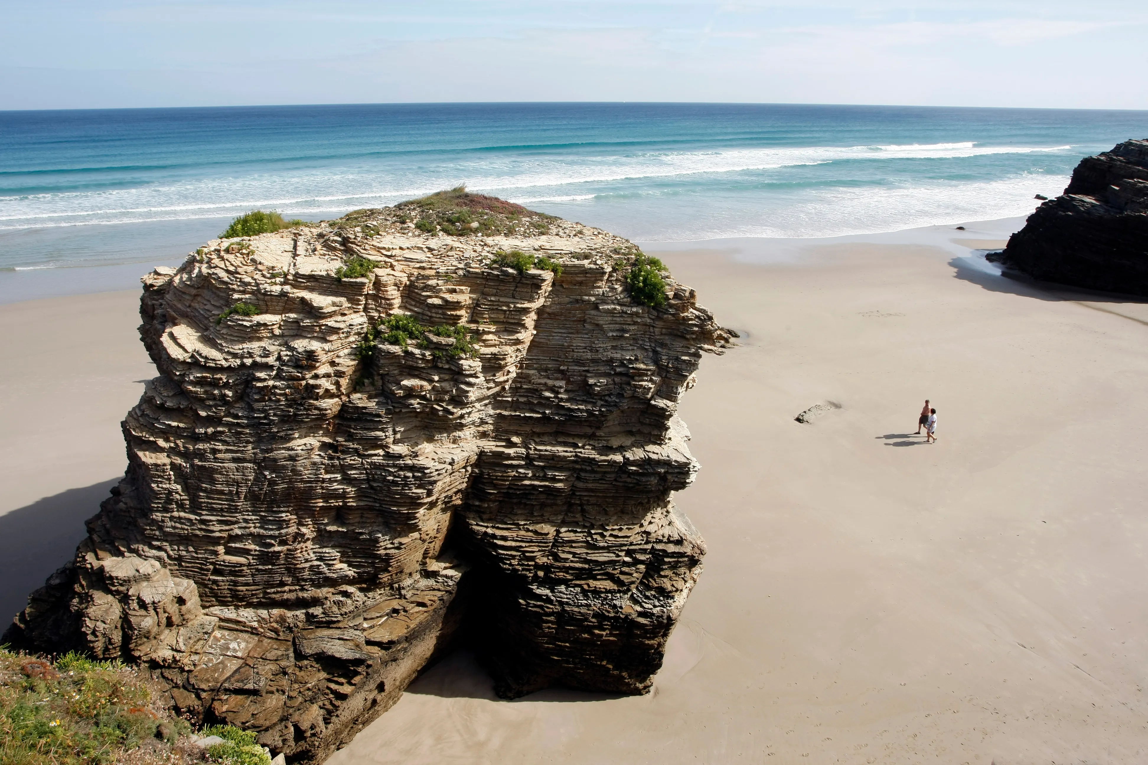
Praia das Catedrais, whose older name is Augasantas, lies on the Cantabrian coast near Ribadeo. Its cliffs contain quartz-rich sandstones and quartzites interlayered with darker slates. Waves exploit joints, bedding planes and other weaknesses in the rock.
The sequence can be seen along the shore. A fracture widens into a marine cave. Continued erosion can produce a blowhole or open a tunnel. When two openings meet, an arch remains; when its roof eventually collapses, an isolated stack is left offshore. Sand carried by waves also acts as an abrasive against the cliff base.
The beach is accessible only around low tide; at high tide the sand, caves and principal arches disappear beneath the water. Check the Ribadeo tide table first and plan to arrive well before low tide so there is time to walk out and return safely.
Free authorization is required during Easter Week and throughout July, August and September. Apply through the Xunta de Galicia reservation website up to 30 days before the visit. Select the date, enter the visitor details and keep the confirmation and QR code available on your phone or on paper. Each visitor should also carry the identity document used for the reservation. Outside those regulated periods, access is free without a reservation.
The authorization controls the number of visitors; it does not select the tide for you. Check both the reservation date and low-tide time before organizing transport. Follow the marked access points and keep clear of the cliff base, where erosion can dislodge rock.
Praia das Catedrais is well north of the final Camino Francés stages, while the Rías Baixas accompany our Portuguese coastal and Spiritual routes. We can add a private coastal extension when you start planning.